
Greetings Nuttall-ites! Happy New Year! As our calendar turns in a couple of days to 2019, we enter the actual 200-year anniversary of Nuttall’s journey in the Arkansas territory.
On this day, Dec. 30, 1818, Nuttall was still on the Mississippi River, moving downstream from the first of the Chickasaw Bluffs–which is approximately 50 miles upstream from Memphis. The “Fourth Chickasaw Bluff” is at Memphis itself. It was a foggy morning on the river. Nuttall writes “We proceeded as soon as the dense fog…would permit…” They went river left, to avoid “a horrid pass, which resembled a submerged forest” and beached at the base of the bluff to examine it.
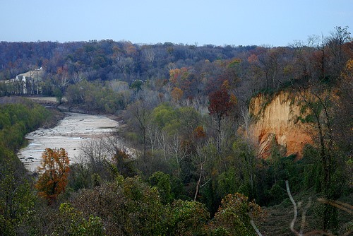
The cliffs were up to 300′ high and composed of a “stratified, ferruginous, and blueish sandy clay, probably a disintegrated sandstone [pg. 58].” Wikipedia says that the bluffs are formed from pleistocene loess–that is, wind-blown silt. The loess may be as thick as 70 feet on top of fluvial deposits from the Pliocene. The “ferruginous”–rusty iron oxides–nature of the lower deposits that Nuttall describes can be seen in the contemporary photo of the bluff above. (The photo is from the Mississippi River in West Tennessee blog – http://msrivertn.blogspot.com/).
Nuttall has almost more two weeks on the Mississippi until he arrives at the mouth of the White River on Jan. 12, 1819.
****