
Ozwash is my mashup of “Ozarks” and “Ouachitas,” an area known as the Interior Highlands to geographers and geologists. It is so called because it is the only extensive highland area between the Appalachians to the east and the Rockies to the west.
To quote the US Geological Survey:
The ancient, eroded mountains of the Ozark-Ouachita Highlands stand surrounded by the nearly flat-lying sedimentary rocks and deposits of the Interior and Atlantic Plains provinces.
Pronounce it “oz” as in the “wizard of ,” and “wash” like what you do a dirty car. If you are not familiar with the Ouachitas, they are pronounced like “wash – i – tas.”
The label Interior Highlands points to the physical shape of the land; by Ozwash I aim to emphasize it as a peopled place–the linked, overlapping, intertwining histories of plants, and geologies, and peoples. The western edge of the Interior Highlands is my home.
The Ozwash region is composed of three geologic units, the Ozarks to the north, the Ouachitas to the south, and the Arkansas Valley between them. The Arkansas Valley is more than an area carved out by the Arkansas River, it is really the sunken, rolling wave front of the Ouachita Mountains as they were being forced up from the south by plate tectonics. Geologists call it the Arkoma Basin.
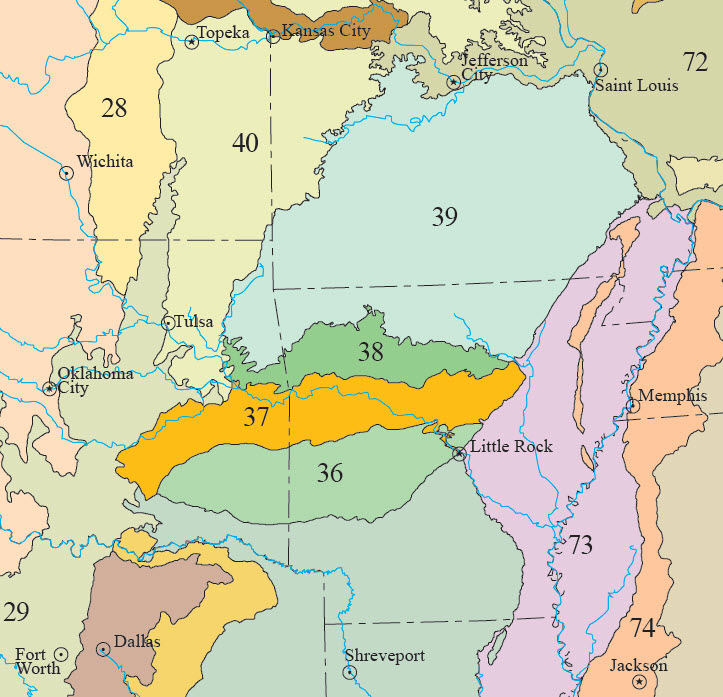
The EPA ecoregions map divides the traditional “Ozarks” into two regions, the Boston Mountains and the Ozark Highlands (#38 and #39, respectively), on the above map. The Ouachita Mountains are region #36. The Arkansas Valley is number #37.
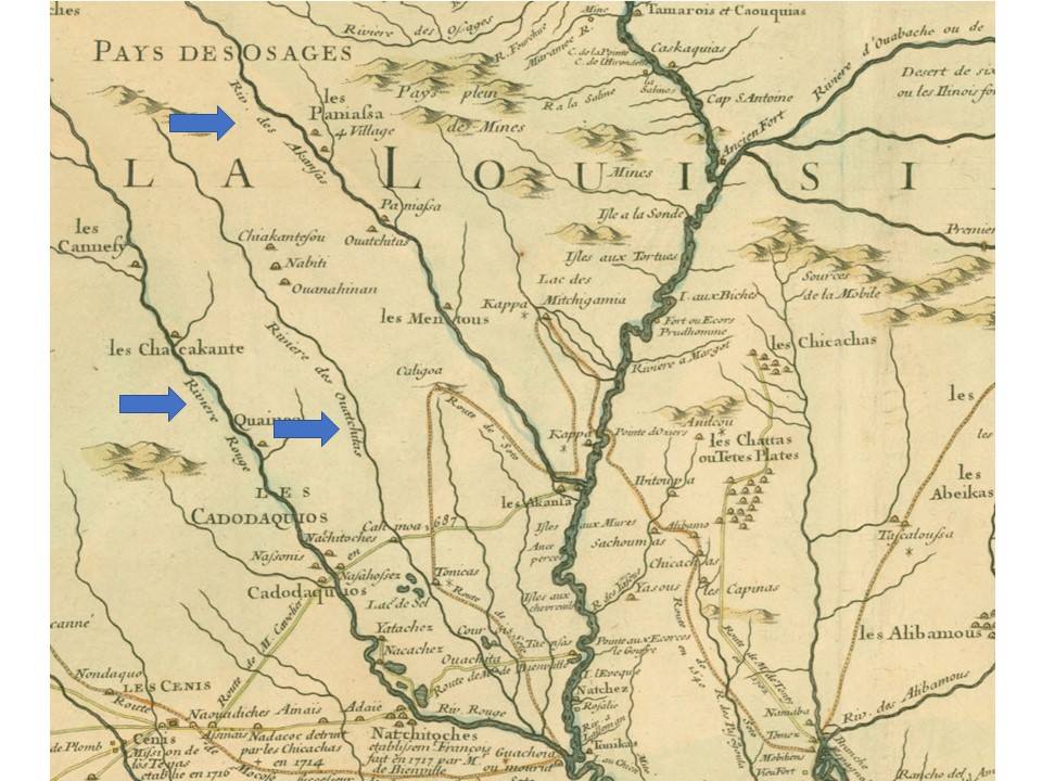
In coining a new name for the region we are continuing a long tradition. Both “Ozark” and “Ouachita” are old names with interesting and somewhat murky roots. Ozarks and Arkansas both derive from the same root source–French versions of the name for the Native American tribe whose descendants today go by Quapaw. Ouachitas is also an old name, tracing back to a native source, for a group probably related to today’s Caddo, or at least speaking a Caddoan language. “Ouachitas” shows up on a very early 18th century French map of North America created in 1718. Read more about this map and the rivers Ouachita here.