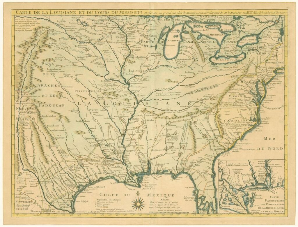
Guillaume Delisle was a French cartographer (1675-1726) who became known for popular and reasonably accurate maps of the newly explored Americas.
While he did not explore the Americas in person, he was one of the first cartographers to take a scientific and data-driven approach in constructing his maps. As a consequence, his map of French North America was widely known and influential. (Though he did stretch the boundaries and exaggerate the extent of French influence.)
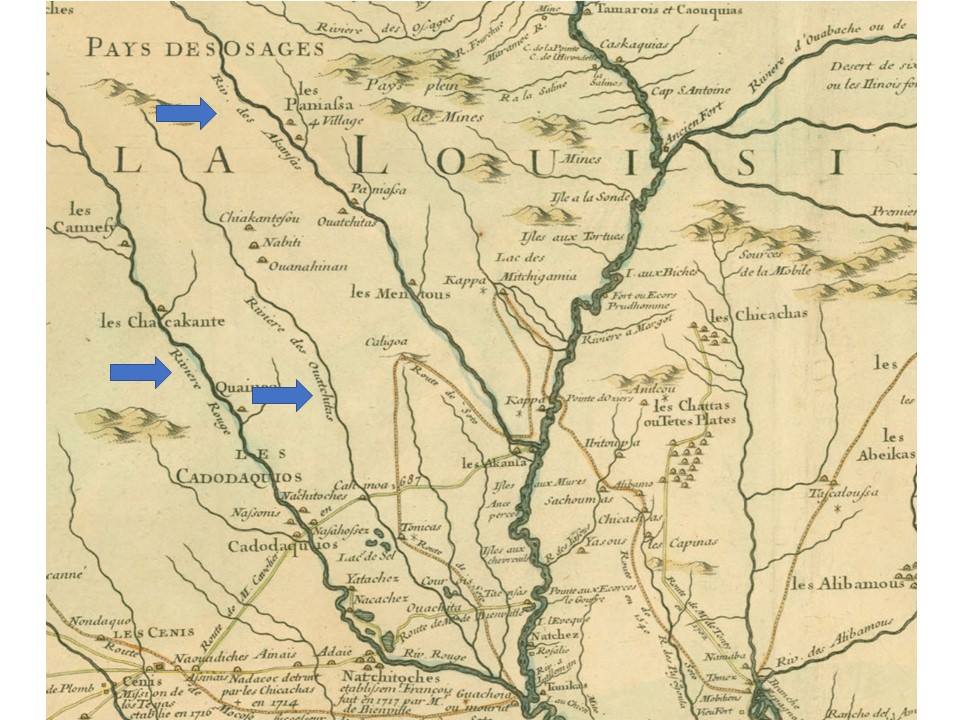
There are several items of interest to highlight on the magnified excerpt below which is centered on what is today Oklahoma, Arkansas, Louisiana, and east Texas. Both the Arkansas and Red Rivers are shown (“Riviere des Akansas” and “Riv. Rouge”). It is clear that the southern portions of their routes were better known than the more northern and western portions.
One of the most interesting items to me is labeling and placement of the “Riviere des Oautchitas.” There has been debate in some circles regarding the origin of “Ouachita” as a place name. Note there are no mountains labeled as the Ouachitas here. Even when Nuttall visited he did not use the name Ouachitas for the mountains, usually referring to them as the “Mazerns” using a name applied by Darby. But the Ouachita River was known and mapped reasonably accurately in its southern portion. Note there is also a village labeled “Oautchitas,” and it is shown on the Arkansas River, not on the Ouachita.
Today we know two “Ouachita” rivers–one with the French spelling that rises at Rich Mountain in Arkansas, near the OK-AR state border, and flows east and then south to near the Red River. (The Ouachita combines with the Tensas to form the Black River some forty miles above where the Black River then flows into the Red.) On the other hand there is the Washita River (using the English spelling) in Oklahoma.
Delisle’s map seems to combine the two, making the Ouatchitas a longer river more on par with the Arkansas and the Red.
Note also there is a Ouatchitas shown as a tribal name upstream on the Arkansas. Who that was or where the village was actually located is not clear to me.
I think you’ll agree this map is an interesting window into the French view of North America and I hope you enjoy spending some time with it.